
Geodatabase and Spatial Layers
The following 15 geospatial layers and aerial imagery layer comprise the LMP geodatabase used for site-specific characterization of subject landowner properties. Each layer is referenced by its name within the geodatabase and information is provided about the source layers name, location, and a brief description of the content found within the layer.
Table of Contents
Historical Structures 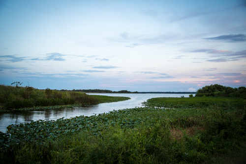
Cemeteries
Hydrologic
Listed Species
Conservation Lands
Critical Habitat
Rare Habitat
Sea Level
iMap
EDDMaps
Counties
Roads
Soil
Parcels
Mills
World Imagery
Forest of Recognized Importance
Layers
Historical Structures
- Layer Source Name: Historical Structure Locations in Florida-July 2016, FGDL
- Description: This dataset contains historic structure locations and attributes as recorded at the Florida Master Site File.
- Layer Source Location: http://www.fgdl.org/metadataexplorer/explorer.jsp
Cemeteries
- Layer Source Name: Historic Cemeteries in Florida-July 2016, FGDL
- Description: This dataset contains historic cemetery boundaries and basic cemetery attributes as recorded at the Florida Master Site File.
- Layer Source Location: http://www.fgdl.org/metadataexplorer/explorer.jsp
Hydrologic
- Layer Source Name: USFWS National Wetlands Inventory-Polygons-October 2014, FGDL
- Description: This data set represents the extent, approximate location and type of wetlands and deepwater habitats in the conterminous United States. These data delineate the areal extent of wetlands and surface waters as defined by Cowardin et al. (1979). Certain wetland habitats are excluded from the National mapping program because of the limitations of aerial imagery as the primary data source used to detect wetlands. These habitats include seagrasses or submerged aquatic vegetation that are found in the intertidal and subtidal zones of estuaries and near shore coastal waters. Some deepwater reef communities (coral or tuberficid worm reefs) have also been excluded from the inventory. These habitats, because of their depth, go undetected by aerial imagery. By policy, the Service also excludes certain types of "farmed wetlands" as may be defined by the Food Security Act or that do not coincide with the Cowardin et al. definition. Contact the Service's Regional Wetland Coordinator for additional information on what types of farmed wetlands are included on wetland maps
- Layer Source Location: http://www.fgdl.org/metadataexplorer/explorer.jsp
Listed Species
- Layer Source Name: U.S. FISH & WILDLIFE SERVICE ENVIRONMENTAL CONSERVATION ONLINE SYSTEM (ECOS) FEDERALLY LISTED SPECIES-2016, FGDL
- Description: This data set represents federally-listed species known to be present in each of the counties that make up the North Florida, Panama City, and South Florida Ecological Services Areas of the U.S. Fish & Wildlife Service. The Environmental Conservation Online System (ECOS) is a gateway website that provides access to data systems in the U.S. Fish & Wildlife Service (Service) and other government data sources. This central point of access assists Service personnel in managing data and information, and it provides public access to information from numerous Service databases. As of February 13, 2015, the data in this report has been updated to use a different set of information. Results are based on where the species is believed to or known to occur. The FWS feels utilizing this data set is a better representation of species occurrence. Note: There may be other federally listed species that are not currently known or expected to occur in this state but are covered by the ESA wherever they are found; thus if new surveys detected them in this state they are still covered by the ESA. The FWS is using the best information available on this date to generate this list. The data is not meant as a substitute for site-specific surveys. The code key below and in the User Notes denotes the species designation. Code Key: E=Endangered, T=Threatened, PE=Proposed Endangered, PT=Proposed Threatened, C=Candidate, BGEPA=Bald and Golden Eagle Protection Act.
- Layer Source Location: http://www.fgdl.org/metadataexplorer/explorer.jsp
Conservation Lands
- Layer Source Name: Florida Managed Area March 2016, FGDL
- Description: FLORIDA CONSERVATION LANDS (layer name FLMA): This is a polygon data layer for public (and some private) lands that the Florida Natural Areas Inventory (FNAI) has identified as having natural resource value and that are being managed at least partially for conservation purposes. The term "Managed Area" refers to a managed conservation land.
- Layer Source Location: http://www.fgdl.org/metadataexplorer/explorer.jsp
Critical Habitat
- Layer Source Name: U.S. FWS Threatened & Endangered Species Active Critical Habitat Report
- Description: Spatial data for active proposed and final critical habitat for threatened and endangered species.
- Layer Source Location: http://ecos.fws.gov/ecp/report/table/critical-habitat.html
Rare Habitat
- Layer Source Name:Rare Species Habitat Conservation Priorities
- Description: This layer identifies habitat for rare plant and animal species with habitat ranked based on G and S ranks and overlap between species.
- Layer Source Location: http://atoll.floridamarine.org/metadata/custom/fwli/raresp_hab.htm
Sea Level
- Layer Source Name: Sea-Level Rise
- Description: These layers show the rise of sea level from zero to six feet.
- Layer Source Location: https://coast.noaa.gov/slrdata/
iMap
- Layer Source Name: Invasive Species, Florida iMapInvasives. 2016.
- Description: Point data of invasive species.
- Layer Source Location: http://login.imapinvasives.org/flimi/ (accessed August 19, 2016).
EDDMaps
- Layer Source Name: EDDMaps
- Layer Source Name: North Florida Mills, 2015
- Layer Source Name: ESRI World Imagery, 2016
- Layer Source Location: http://www.esri.com/software/arcgis/arcgisonline
- Layer Source Name: FORI
- Description: Point data of invasive species collected by EDDMaps users.
- Layer Source Location: https://www.eddmaps.org/tools/
Counties
- Layer Source Name: Florida County Boundaries September 2015, FDGL
- Description: This dataset contains the boundaries of Florida's 67 counties. The interior county boundaries are from the U.S. Census Bureau's TIGER data. The coastal boundaries are from the previous version of Florida County Boundaries (CNTBND) and are used by Florida Department of Transportation's Efficient Transportation Decision Making (ETDM) process for display purposes. GeoPlan maintains three county boundary layers: COUNTYSHORE_AREAS, CNTBND, and COUNTY. These three layers will all have the same interior boundaries and different coastal boundaries. The interior boundaries come from the MAF/TIGER Database that is updated yearly by the U.S. Census Bureau. The coastal boundaries differ in the following way: 1) COUNTYSHORE_AREAS - FWRI's detailed shoreline layer (updated periodically); 2) CNTBND - moderately generalized shoreline designed for ETDM display, sourced from historic U.S. Census Bureau data; 3) COUNTY - highly generalized shoreline designed for ETDM display, sourced from historic U.S. Census Bureau data.
- Layer Source Location: http://www.fgdl.org/metadataexplorer/explorer.jsp
Roads
- Layer Source Name: USGS 1:24,000 Roads
- Description: This coverage contains the digital line graphs (DLG) for the State of Florida as compiled by the Earth Science Information Center of the U.S. Geological Survey. The RDS24 coverage is a subset of all transportation data from the DLG data files derived from the 1:24,000-scale and other large-scale maps. This dataset has been updated from the previous version on Florida Geographic Data Library (FGDL) 3.0.
- Layer Source Location: http://www.fgdl.org/metadataexplorer/explorer.jsp
Soil
- Layer Source Name: Soil Survey Spatial and Tabular Data
- Description: This dataset contains the boundaries and descriptions of soil types.
- Layer Source Location: https://gdg.sc.egov.usda.gov/GDGOrder.aspx
Parcels > 10 acres
- Layer Source Name: Florida Parcel Data by County 2010, FGDL
- Description: This dataset contains parcel boundaries for each county in Florida, with each parcel's associated tax information from the Florida Department of Revenue's tax database.
- Layer Source Location: http://www.fgdl.org/metadataexplorer/explorer.jsp
Mills
- Description: Point location data of mills available in the Northwest Florida region.
- Layer Source Location: Southern Forestry Consultants Internal Geospatial Layers http://www.soforest.com/geospatial.html
Imagery: World Imagery
- Description: This map service presents satellite imagery for the world and high-resolution imagery for the United States and other areas around the world.
Forest of Recognized Importance
- Description:Forests of Recognized Importance identified within the region based on the best available science, regional conservation initiatives and collaborative input from the Support Team.
- Layer Source Location:
